

Yanasa TV News
HESS Leak of over 20,000 barrels of Oil + Brine Floods North Dakota Farm Fields
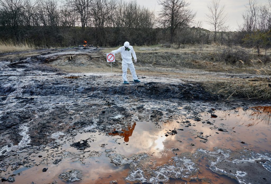
It’s not the biggest spill in U.S. history—but it’s big enough to matter. Hess’s leak outside Stanley, North Dakota released an estimated 20,000 barrels (≈840,000 gallons)of an oil-and-brine emulsion, putting it in the same size class as the 2013 Tioga/Tesoro wheat-field disaster (~20,600 barrels, ≈865,000 gallons) that became North Dakota’s benchmark for large inland spills. The crucial difference: Tioga was essentially all crude oil, while the Hess total includes a substantial volume of salty produced water, meaning the oil-only portion here is likely smaller—but the soil- and groundwater-risk from brine can be longer-lived than the sheen you can see.

What We Know About the Hess Spill Near Stanley — And What Comes Next
The basics: what happened, where, and how much
State regulators say a Hess-operated 6-inch flow line leaked an emulsion of crude oil and produced water (brine)about 4 miles northwest of Stanley in Mountrail County. The release is currently estimated at 20,000 barrels—roughly 840,000 gallons. The fluid surfaced and traveled ~250 yards over agricultural land before responders built a clay berm to hold it. As of now, the state reports no water resources have been impacted. The cause is under investigation. NDDEQ
Hess’s own timeline, confirmed by a state spill investigator, is that on Sept. 2 they noticed data anomalies and checked, tests came back negative, and on Sept. 12 field crews found vegetation die-off, prompting a Sept. 13 report to the North Dakota Department of Environmental Quality (NDDEQ). InForum
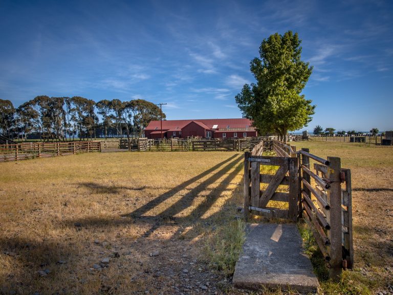
The immediate area is working farm country. Mountrail County counted ~1.17 million acres in farms in the latest agricultural census, with a heavy emphasis on crops (wheat, canola, soybeans) and cattle. In short: the release occurred between two well pads in active ag land, which heightens concern about soils and any shallow groundwater. USDA NASS
How much land is impacted? Regulators have not published acreage yet. We know the surface flow path (~250 yards) and that the subsurface extent is still being delineated, which is typical early on. NDDEQ
“They say it’s safe, but they don’t know the full extent yet.” Is that credible?
Yes—both statements can be true in the first days. NDDEQ’s status—no known impact to drinking water or surface waters “at this time”—reflects what field crews can see and sample quickly. At the same time, officials have said they don’t yet know how deep salts and hydrocarbons have migrated, which takes weeks of soil coring, chloride profiling, and groundwater screening to answer. NDDEQ
A useful cautionary parallel is East Palestine, Ohio: regulators provided early “safe so far” updates while also continuing months of confirmation sampling and longer-term well testing after the 2023 derailment.
The results were not as safe and clean as initially reported. In the days after the Feb. 3, 2023 derailment, Sen. J.D. Vance helped spotlight visible contamination by posting a creek-bank video at Leslie Run: he scraped the sediment with a stick and a rainbow-sheen spread across the water, pointing to dead fish and “chemicals in the water.” That clip went wide and kept national attention on the creeks. State wildlife officials initially estimated ~3,500 fish died across about 7.5 miles of streams; later totals put the number at ~43,700 aquatic animals (about 38k minnows plus ~5,500 other fish, amphibians, and crayfish). Meanwhile, EPA and Ohio EPA kept long-tail testing/cleanup in Sulphur Run and Leslie Run well into 2024–2025, even as officials said municipal drinking water was safe—illustrating how “safe so far” can coexist with months of creek work and verification.
Residents around East Palestine reported a cluster of acute, irritant-type symptoms after the Feb. 2023 derailment and burn: headaches, sore throats, cough, burning or watery eyes, skin rashes, nausea, and dizziness, often accompanied by chemical odors in low-lying creek areas. Ohio opened a dedicated health clinic to evaluate and track complaints as testing and cleanup continued, while CDC/ATSDR teams ran community ACE symptom surveys in Ohio and Pennsylvania. Even some CDC field investigators briefly experienced sore throat, headaches, coughing, and nauseawhile working in the area—consistent with what residents were reporting. Follow-up analyses of Pennsylvania first responders likewise linked certain job duties to higher odds of respiratory and irritation symptoms, underscoring short-term exposure risks even as environmental monitoring found air and municipal water generally within safety standards. AP News
That episode shows why ongoing monitoring and transparent data release matter even when early results look acceptable. Different incident, different chemicals—but the lesson is the same: “safe today” does not guarantee “no issues later” without continued, public sampling. US EPA
What’s in the spill — and why brine is uniquely hard on farm ground
This release is an oil + brine emulsion. The two components damage land in different ways:
- Brine (produced water): Bakken brines are extremely salty—often 200,000–350,000 mg/L total dissolved solids (TDS)—dominated by sodium and chloride. Chloride is highly mobile, so it can move downward with moisture and threaten shallow groundwater. Sodium wrecks soil structure (sodicity), dispersing clays, sealing pores, and stunting roots; soils can remain unproductive for years without aggressive reclamation. Oil Research
- Oil (hydrocarbons): Oil smothers vegetation and leaves TPH/PAH residues in soil. Common remedies include excavation and landfarming/bioremediation. Compared with brine, hydrocarbon impacts are often faster to fixonce removed and aerated, but it depends on depth, texture, and weather. (NDDEQ and NDSU guidance outlines these approaches.) North Dakota State University
What subsurface movement could look like here:
Expect crews to grid-sample soils, map electrical conductivity (EC) and chloride in vertical profiles, and install temporary groundwater screening points down-gradient. Because chloride is conservative (it doesn’t stick to soil much), it’s the primary indicator for groundwater risk; sodium is addressed in soil with calcium amendments (commonly gypsum) plus leaching. Where salts have moved deeper, teams may add tile drains or staged leachate management to pull them out. These methods are standard in ND for brine releases. NDDEQ
Who could be affected:
- Landowner/tenant (crop loss, soil productivity hits).
- Neighboring fields (if salts move laterally in shallow groundwater).
- Private wells and livestock water if located down-gradient in the shallow aquifer.
- Wetlands/ephemeral draws if present nearby.
So far, NDDEQ reports no impacts to water resources, but that’s precisely what the upcoming subsurface work aims to keep true. NDDEQ
How toxic are brine and oil to water?
Brine (produced water). Oilfield brine is extremely salty (dominated by sodium & chloride). In streams and shallow groundwater, chloride is the main concern: the U.S. EPA’s aquatic-life criteria are 230 mg/L (chronic) and 860 mg/L (acute)—levels easily exceeded if brine reaches water. For people, chloride and total dissolved solids (TDS) mainly affect taste and corrosion at 250 mg/L (chloride) and 500 mg/L (TDS)(secondary drinking-water standards). For soils and crops, high sodium/chloride kills vegetation, destroys soil structure, and depresses yields until salts are removed or leached. US EPA
Crude oil (hydrocarbons). Even when diluted, dissolved and dispersed PAHs from oil can harm fish and other aquatic life (embryo heart defects, impaired survival) at very low µg/L levels; sunken “submerged oil” mixed with sediments can persist and continue exposing benthic organisms. PMC
Livestock & wells. Cattle and other stock start running into problems as TDS climbs above ~5,000–10,000 mg/L(species/age dependent). Private wells can become unpalatable well before that if chloride rises, even if not acutely toxic. North Dakota State University
Cases where contamination lingered and mattered
- Blacktail Creek, ND (2015) — A pipeline released ~3 million gallons of produced water (brine) into a creek near Williston. EPA documented ongoing recovery and uncertainty about oil/brine discharging from the subsurface/alluvial system; years later, the operator paid criminal and civil penalties tied to the incident, underscoring long-tail impacts on a small watershed. response.epa.gov
- East Poplar Oil Field, MT (USGS) — Decades of brine handling caused widespread groundwater salinization(up to ~18 sq mi; 15–37 billion gallons of groundwater affected). The City of Poplar’s public wells were impacted and ultimately replaced by a pipeline to a cleaner source—classic evidence that brine plumes can persist and migrate in shallow aquifers. U.S. Geological Survey
- Kalamazoo River, MI (2010) — A pipeline rupture released heavy crude to Talmadge Creek/Kalamazoo River. Extensive dredging and restoration followed; agencies documented harm to fish and wildlife and concerns about submerged oil continuing to expose bottom-dwelling organisms—demonstrating oil’s long-term ecological footprint in freshwater. U.S. Fish and Wildlife Service
- Tioga, ND Farmland (2013) — ~20,600 barrels of oil under cropland required multi-year excavation/thermal treatment; while water impacts were limited, the case shows how hydrocarbon releases can sideline farmland for seasons. NDDEQ
What this means for incidents like the Stanley (Hess) spill
- If brine reaches shallow groundwater or drainage draws, chloride can travel with melt/rainwater and push concentrations above aquatic-life thresholds, stressing biota even without obvious fish kills. That’s why agencies focus on chloride/EC profiles in soils and place monitoring points down-gradient. US EPA
- If oil mixes into sediments, it can persist in low-oxygen spots and expose benthic life over time, even after surface sheen is gone. NOAA Fisheries
- For livestock and domestic wells, the practical risk is salty, unpalatable water(and performance hits for stock) long before acute toxicity—hence precautionary well screening in the direction of groundwater flow. North Dakota State University
Bottom line: Brine and oil affect water in different ways, but both can leave long shadows. Brine’s salts are mobile and can linger in aquifers; oil’s toxic fractions can injure aquatic life at very low concentrations and persist in sediments. History shows impacts can last years without aggressive interception, treatment, and long-term monitoring.
Cleanup: reality check on timelines
Initial surface response (containment, excavation of visibly contaminated soil) is expected to run into mid-November, which the state characterized as “optimistic”—a reasonable target for Phase 1 before freeze-up. Full reclamation—especially where salts have penetrated—often spans multiple seasons in North Dakota. Comparable large releases in the state (e.g., Tioga 2013 oil pipeline spill, Blacktail Creek 2015 brine spill) required years of remediation and monitoring to restore soils and water quality. Expect ongoing sampling and soil treatment through at least the next growing season, with progress reported publicly. InForum
winter can slow things way down, and it’s very common for brine-and-oil cleanups in North Dakota to pause and resume in spring. Here’s what that means in practice.
What freeze does to cleanup
- Excavation gets harder. Once frost sets (often to several feet), digging, hauling, and screening soils become slower and pricier. Contractors can use ground-thaw heaters or insulated tents, but productivity drops.
- Bioremediation stalls. Cold temps suppress microbial activity, so landfarming/bioremediation of oil is largely ineffective until soils warm up.
- Salt treatment must wait. Brine remediation depends on leaching salts downward and out after adding calcium amendments (e.g., gypsum). That requires unfrozen, percolating soils—so most salt-focused treatments are staged for spring.
- Monitoring is limited. Installing/sampling shallow screens and pushing soil cores through frozen ground is tougher; labs still run, but delineation often finishes post-thaw.
Could it continue in spring?
Almost certainly. A typical cadence is:
- Fall/early-winter: Finish “Phase 1”—containment, surface excavation, stockpiling, temporary covers/liners, storm-water controls, and initial mapping.
- Spring (post-thaw): Resume subsurface delineation, update chloride/EC maps, excavate any remaining hot spots, then apply gypsum (or similar Ca source) and run managed leaching; consider tile drains/interceptor trenches if salts penetrated deeper.
How winter/spring dynamics affect spread
- Winter = mostly immobilized water, not zero movement. Frozen soil sharply limits percolation. However, as soils freeze, salts can migrate toward the freezing front, creating saline crusts near the surface. That’s a visual sign but not necessarily lateral spread.
- Thaw = mobilization risk. During snowmelt and spring rains, chloride (very mobile) can flush downward and downslope. If containment isn’t tight, meltwater can carry salts/oil film into ditches, ephemeral draws, or low spots. This is the window with the highest off-site risk.
- Groundwater considerations. If the release reached below the frost zone, slow winter migration can still occurin unfrozen layers. Spring recharge can push a chloride pulse toward the water table if not intercepted.
How to reduce winter/spring risk (what you should expect to see)
- Maintain and winterize containment: keep clay berms, add lined sumps, pumps, and snow-berm/wattlecontrols. Keep impacted soil stockpiles on liners and covered.
- Pre-thaw interception: if data show deeper salts, install interceptor trenches/tilebefore soils lock up, or plan them for early spring.
- Runoff management plan: engineered pathways so meltwater stays on-pad and is pumped/treated; sample any discharge.
- Spring leaching plan: staged gypsum application + irrigation/rainfall management to move sodium off exchange sites and flush chloride to controlled drains—not into neighbors’ fields.
- Adaptive monitoring: resample soils and shallow groundwater after first big melt/rain events; expand controls if chloride shows up down-gradient.
Bottom line
- If remnants remain into freeze, the project doesn’t end—it shifts to containment and staging.
- Yes, work will continue in spring—that’s when the most effective salt remediation happens.
- Spread risk is highest at thaw, so success hinges on winter containment + spring runoff control and fast follow-up with amendments/leaching once soils are workable.
Why operators and regulators call pipelines “safest”—and the nuance
For moving big volumes of oil and produced water over land, pipelines generally have the lowest incident rates per ton-mile compared with rail or truck. The U.S. Pipeline and Hazardous Materials Safety Administration (PHMSA) states plainly: “Pipeline systems are the safest means to move these products.” A PHMSA Report to Congress adds nuance: on several safety metrics (e.g., incident rates, percent spilled), pipelines tend to outperform truck and rail, though each mode has tradeoffs and human-consequence metrics can rank differently. Independent safety advocates also note that while rail has more incidents, pipeline failures can release larger volumes when they do occur. All of this can be true at once—pipelines are statistically safer overall, yet not risk-free, and rare failures can be severe, which is why integrity management and leak detection on short “flow lines” like this one matter.